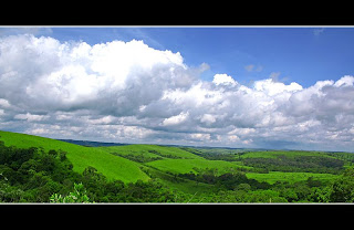
Stung Treng Province

INTRODUCTION :
Stung Treng is a northern province of Cambodia. It was formerly called Xieng Teng and was once a part of the vast Khmer Empire, then the Lao kingdom of Lan Xang and later the Lao kingdom of Champassack. During the period of French Indochina it was again ceded to Cambodia.

The provincial capital is also named Stung Treng and is an important trade hub with a few hints of Lao influence scattered about, owing to the fact that the Lao border is about 50 km away. It’s a friendly, quiet country town situated on the confluence of the San River and the Mekong River. It actually sits on the banks of the San River, with the mighty Mekong coming into the picture on the northeastern outskirts of he town.

GEORGRAPHY :
Stung Treng province, which covers an area of 11,092 square kilometres, is a remote and sparsely populated province in the northeast of Cambodia. It borders Lao to the north, Ratanakiri to the east, Preah Vihear to the west and Kratie and Kompong Thom to the south. The province is divided into five district, 34 communes and 128 villages. Stung Treng is a unique province quite distinct from other Cambodian provinces in the Mekong basin. Extensive forests, intersecting rivers and streams and low population density characterize it.

Stung Treng includes also the western chunk of the massive Virachey National Park, accessible from Siem Pang, a small beautiful town on the Tonle Kong. The province also features three big rivers the Tonle Kong, the Tonle San and the mighty Mekong with its hundreds of small islands scattered on the river stretch in Stung Treng Province.

Preah Vihear Temple

Preah Vihear is quite a big northern province of Cambodia. Its capital is called Phnom Tbeng Meanchey. The province itself is named after the temple of Prasat Preah Vihear, what is definitely the hotspot of this province. Much of the province is extremely remote and strongly forested. Unfortunately do large logging companies reduce the natural landscape by carving huge tracts of pristine tropical hardwoods out of the locations. It is also one of the least populated provinces in the Kingdom of Cambodia. This tranquil site is popular for the Preah Vihear temple, standing in the vicinity of the borderline between Thailand and Cambodia.
The province has one of the worst infrastructures in the country – there are even no proper Major Roads in existence. Going around this province is not that easy if you’re used to proper roads and usual transportation possibilities, as there are only a few pick-ups or some money-hunting moto drivers to take you where you would like to go.

Whatsoever the province has a lot to offer for those, who are interested in ancient temple structures and remote villages without touristy influence. Here in Preah Vihear you may find three of the most impressive legacies from the Angkorian era: the mountain temple of Prasat Preah Vihear, the 10th-century capital of Koh Ker and the mighty Preak Khan. Koh Ker is nowadays easily accessible from Siem Reap via Beng Mealea, but the other two still remain difficult to visit, requiring long and tough overland journeys and a distinct possibility to spend a night in the jungle. During the wet season these places are more or less unreachable. But there are governmental plans to develop the region for a smooth but constant tourism, building roads and improving infrastructure.

The provincial capital Tbeng Meanchey is due to the state of the infrastructure and it’s geographical location not visited by a lot of foreigners. Most of them don’t make it here worrying about the street conditions and the backcountry feeling of no fast supply in need. The city is sprawling and dusty and consists of little more than two small major dirt roads form South to North. There is nothing interesting in town or to do, so it has necessarily become more a stopover on the way to Koh Ker and Preah Khan.

Preah Vihear Temple :

Preah Vihear Temple locates at Preah Vihear Province of Cambodia and sites at the most spectacular location of any Khmer site at the near by Thailand border. It is 100 kilometers northeast of Siem Reap; Si Sa Ket Province, Thailand. It was a large temple which was built on the top of Chuor Phnom Dangrek which divides the Khorat Plateau from the lowland Cambodian plain below. It is about 550 meters from the ground level of Cambodia side.

Preah Vihear temple, which took over 300 years to complete the construction by a few famous Khmer king, was firstly built from 893 by the king Yasovarman I who ruled the country from 889 to probably 910. The majority of temple edifice was established by king Suryavarman I (1002 - 1049) and finally the temple was completed during the reign of great king Suryavarman II (1113 – 1150), the well-known king who was the founder of magnificent temple of Angkor Wat at Siem Reap province (Rooney 2006). King Suryavarman II known as a great khmer king who dominated the Khorat Plateau, Lopburi and even further north in Thailand and he extended the Khmer Empire to the border of Pagan in Myanmar; and south into the northern part of the Malay Peninsula (Coe D. 2004).

The main purpose of the temple is the mountain temple which is the symbol of sacred mountain “Meru” where is the abode of all the gods of Hindu. The temple was mainly dedicated to the supreme god “Shiva” (Rooney 2006).

Preah Vihear temple is the reason of arguments between Cambodia and Thailand. On the 23rd March 1907, after the border treaty between France protectorate (1863 – 1953) and Thailand, land and temple was returned to Cambodian sovereignty. In 1954, Thai took control Preah Vihear by arm force again and removed many pieces of stones from the temple. It was the reason of Prime Minister Sihanouk during that time took the argument to the International court on 6th October 1959. The justice court awarded Preah Vihear temple on 15th June 1962 to Cambodia. Moreover the court judged that Thai Authority has to compulsorily remove their arm force and restore the temple by bring back the piece of stone which were removed under Thai occupation to Preah Vihear (International Court of Justice Data Base).

Ba Phnom(Prey Veng)


Ba Phnom is located in Chheur Kach commune, Ba Phnom district, about 78 kilometers east of Phnom Penh and 45 kilometers south of Prey Veng provincial town. Visitors travelling from Phnom Penh along the National Road number 1 should t
turn left at kampong Sneung market and go about 7 kilometers.


There are four mountains in Ba Phnom such as Phnom Sampeou, Phnom Laang, Phnom Thom, and Phnom Bangchor. Ba Phnom was once the ancient city of Nokor Phnom, which was located near these mountains in Ba Phnom district. Few remnants of the city remain. Among those that can be seen are pieces of the ancient teemple Prasat Chan, which was located in front of Wat Vihear Kuk, near the foot of Phnom Sampeou in Cheung Phnom commune. At one time, the city also had a palace and a hall, but both have been destroyed by years of war.

The view from the top of Ba Phnom is very picturesque. There is a big, rocky cave near the mountaintop that shelters wildlife. At the foot of mountain, there is a pagoda, Wat Phnom, also known as Wat Ba Phnom.
A road circles the mountains, and a big pond lies the east of them. People live around the mountains. Ba Phnom has been eyed for tourism development east of the Mekong River, because the area attracts many people on weekends and during Cambodian festivals.


ChongSrok Temple(Prey Veng)


Chong Srok Temple is located in Chong Srok village, Chong Srok commune, Srei Sithar Kandal district, about 38 kilometers north of Prey Veng provincial town. Chong Srok temple was buildt of brick and sandstone in the 7th century. It was built on a high ground in a field of palm tree near a koki tree. Although much of the temple has been destroyed, there remains a sandstone statue of a bull, once revered as a powerfull Bodhisattva, or a Buddhist deity.

Beside the three sites, there are 15 other worship sites for visitors explore:


Virak Chey National Park(R. Kiri)

Virak Chey National Park
It stands along the border of Laos and Vietnam. The Virak Chey National Park occupies a tranquil piece of land, 37 kilometers away from the northeastern part of the Banlung city in Cambodia. This region is fully covered with tropical forest. The mountain range all around the Virak Chey National Park can be best explored on foot.

The primary objective of the Virak Chey National Park in Cambodia is to prevent unnecessary exploitation and degradation of natural biodiversity in and around Cambodia. The initiatives and measures undertaken by the Virak Chey National Park attempt to reduce the risks associated with unnatural exploitation of biodiversity.

The following fields fall under the domain of Virak Chey National Park in Cambodia:

Promotion of ecotourism
Effective protection and management of the National Park
Management of information related with wildlife and biodiversity
Optimization local welfare

The ecotourism initiatives undertaken by the Virak Chey National Park in Cambodia involve building up of trekking trails through the jungle covered mountain range, encouraging the local people to make arrangements for village stay for the tourists visiting the National Park and involving the experienced staffs to guide the tourists through the trekking trails.

The local welfare activities of the Virak Chey National Park in Cambodia include proper management and use of natural and socio-economic resource. These initiatives also involve the spread of education among the local mass.

Protection and management policies of the Virak Chey National Park cover the five-year management and financial plans initiated by the park authority. These policies mainly look after the interests of the employees associated with the Virachey National Park in Cambodia. Performance appraisals, standardizations of data collected by the rangers, wild life related research and daily supervising flights fall under the purview of the protection and management policies.


Mondulkiri Riverside

R
iverside is located in Koh Nhek district, about 150 kilometers north of the provincial town. The site is along the Sre Pok River and features many small islands. The sand here is red and golden, making the site popular with the local people in Koh Nhek district.

When the khmer ceremonies come, expecialy Khmer new year and Pchum Ben, there are lots of national visitor and international visitor go to visit there.


Senmonorom Waterfall(M. Kiri)

S
enMonorom waterfall is located in Sen Monorom district, about 5 kilometers northeast of the provincial town. The road to the waterfall passes numerous rubber, coffee and cashew plantations. The site is very poular with local people during holidays and national festivals, because it is close to the provincial town. This waterfall also has three stages:

  1. First Stage: The water here flows slowly because the waterfall is only 1 meter high and 2 meters wide.
  2. Second Stage: The water flow faster here. In rainy season, the waterfall is 6 to 7 meters high and 8 meters wide; and in dry season, it is 7 to 9 meters high and 4 to 5 meters wide. There is a place to relax on the riverbank.
  3. Third Stage: The waterfall is 1.5 meters high and 1 kilometer from the second stage.